structural engineers

Structural Engineers

Working with Structural Engineers to enhance their projects.

Build it better with a structural building laser scan by Precise Point Data, Inc. The most accurate 3D models in the world. Request a sample.

How do structural engineers benefit from 3D Laser Scanning, Topography and Photogrammetry ?

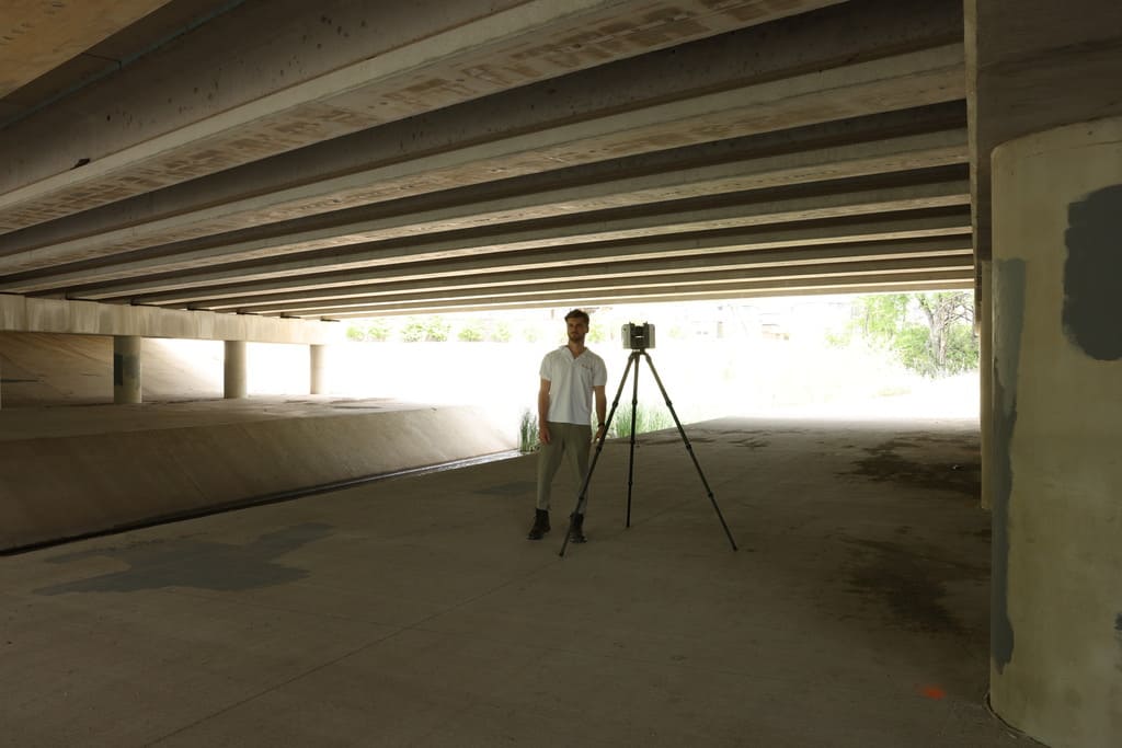
Structural engineers can utilize laser scanning technology to revolutionize their work processes and enhance project outcomes. By scanning their projects millions of highly accurate data points are captured. This can be used to create 3D representations of structures like bridges, tunnels and roads. Furthermore, the 3D representations generated enable engineers to identify cracks, corrosion, or other defects, and make informed decisions about necessary repairs or maintenance. This non-destructive and efficient method provides a comprehensive view of the infrastructure, ensuring the safety, reliability, and longevity of the structures.

Highly Detailed Scans & Models
Highly Detailed
Scans & Models
The Most Precise Measurements
Clearly Defined Results On Time Delivery
Clearly Defined Results
On Time Delivery

Applications of 3D scanning for Structural Engineers include:

Having the most up to date measurements is essential to securing the efficient remodel process, as architecture and construction companies commonly find the existing conditions of a structure often do not reflect the most current Revit or CAD model
Inspection Reports

Laser scanning is a valuable tool for inspecting bridges, tunnels, and roads as it allows engineers to quickly and accurately assess the condition and detect any structural abnormalities. By scanning the structures, the detailed 3D point cloud generated can be inspected can compared to a model, enabling engineers to identify cracks, corrosion, or other defects, and make informed decisions about necessary repairs or maintenance.

Architects determined to get every detail right often find themselves returning to sites again and again to take one more measurement or to get one more photo
Seamless Technology

Our point clouds integrate with leading architectural software like AutoCAD, Revit, or Civil3D. Simply import the provided point cloud directly into the software.

Additionally a high-quality point cloud or photogrammetry mesh can be captured during the construction process and aligned with a model to effectively monitor building progress
Spatial planning

A 3D laser scan of a structure enables an engineer to see the site’s real existing conditions. This can be used to identify cracks, corrosion or other defects and make informed decisions about the necessary maintenance.

Having a building laser scanned will provide a 3D point cloud. This cloud is a visual tool that can be “flown through” to visualize the asset. This can be utilized in board meetings or other decision-making processes.
Placed on your coordinate system

Our point clouds incorporate ground control, meaning that they can be aligned and placed on a client’s existing model coordinate system.

Want to see results in action? Request for sample.

View sample

Explore some of our groundbreaking projects that utilize new scanning and photogrammetry technologies.

View / Download Sample +

Request a Proposal

Let us show you what 3D scanning can do for you!